
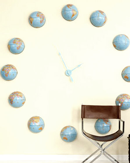
Made from a Map: A GLOBAL Clock
This funky globe clock is sure to wow when understatement just won’t do. Materials Surface-mounted wall clockworks kit; light-blue spray paint; craft knife; six 6-inch-diameter lightweight cardboard globes; bookbinder’s tape; tape measure; 4 feet of cotton...How Humans Are Reshaping the Earth
Humans are increasingly transforming Earth’s surface—through direct activities such as farming, mining, and building, and indirectly by altering its climate. Visit the link to explore these map stories that offer a series of then-and-now satellite imagery...What If? Mapping Nuclear Fallout
One year after the Fukushima disaster in Japan, the nuclear industry is still grappling with how to handle the risks that come with extreme natural disasters. What if something similar happened in the United States? According to the Natural Resources Defense Council,...One Year Later: Tsunami Pictures Then and Now
The people of Japan paused for a moment of silence to mark the one-year anniversary of a powerful earthquake and subsequent tsunami that killed almost 19,000 people and left hundreds of thousands of others homeless. Entire cities and towns were wiped off the land by...Apps We Love: Flickr Photo Map
Explore your world like never before. See photos from anywhere on Earth. Scan the sands of the Sahara or island hop in the Caribbean, go anywhere! Flickr Photo Map is easy and simple. View your current location and see the photography was taken around you. This app is...Ocean Acidification Reaches an All Time High
Some like to point to cycles when dismissing climate change, brushing off warming as simply being the thing that happens right before cooling. In this view, concern about climate change is akin to the naïve worry that half of schools are performing below average. This...SEVEN: USA Population Portrait
Explore US population maps from ArcGIS Online by ESRI help you explore and learn more about where you live. Geography connects our many cultures and societies and influences our way of life. ESRI is built on the philosophy that a geographic approach to problem solving...The Geography of Your Pencil
Have your students map the origins of their pencils in this innovative and complete classroom activity from National Geographic! Click here for the free lesson plan. Your students will be able to: – identify component parts of a pencil – recognize major...What Happens In Vegas Sprawls Across the Desert
What sprawls in Vegas doesn’t stay in Vegas. Time-lapse images from the Landsat series of Earth-monitoring satellites reveal in false-color, multispectral imagery how urban sprawl has stretched out from Nevada’s “Sin City” over the past four...