
By Barbaree Duke and Dr. Joseph Kerski
This article was originally published at Directions Magazine on November 16, 2022.
In December 2000, Dr. R. Golledge penned an article for Directions Magazine called, “Geography in Everyday Life.” It continues to be one of the most widely read articles of the magazine. Why is it still so popular? Is it because Golledge had a way of connecting with us? Or is it because we realize that geography is a fundamental part of our everyday lives?
Perhaps it’s the personal nature of the discussion. Maybe it’s the various ways we hadn’t realized that place matters.
Golledge says, “Many people refuse to believe that they need to know geographic concepts such as location, place recognition, distance evaluation, distribution membership, and regional context. To illustrate the shortcomings of this attitude, let’s investigate everyday ways that illustrate that people actively practice geography – even if they are unaware of what they are doing.”
Let’s discuss whether people still have trouble with location, spatial orientation, and routing. How can we advocate for more rigorous spatial thinking in education? How can we learn more about all of this?
What’s Changed?
Considering the 20 years that have elapsed since Dr. Golledge’s article, what has changed from 2000 to the 2020s?
One obvious difference between 2000 and the 2020s is the rapid advance of all technologies, including geotechnologies. GIS has become like an elevator, a technology that is behind the scenes but “just works,” enabling the food you ate yesterday to reach you, and the power enabling your computer to function right now, and so much more. GPS is embedded in everyday devices and coupled with Web GIS tools, allowing us to see ourselves on an interactive map, or even our friends, helping us to navigate on foot, bicycle, vehicle, mass transit, and airplane from Point A to Point B. These maps and apps have even altered our behavior, from encouraging us to take more steps each day to enabling us to almost never be lost again, to being better prepared for severe weather or re-routing ourselves due to a road closure. While some are still challenged with routing and directions, these tools have enabled millions to “not get lost.” Our technology’s geolocation capabilities are so embedded in our regular activities that we scarcely give thought to all the data and apps working behind the scenes in our normal day. Curiosity: are our devices “actively practicing geography” or are we doing more geographic thinking as a result of our devices?
Maps have become ubiquitous. Everyone, with tools such as ArcGIS Online, can make and share maps. Maps and mapped data have contributed significantly to the era of big data. Web mapping applications, such as dashboards and story maps, have greatly widened the audience interacting daily with geographic information. Maps have also helped those with mobility and sight challenges to navigate through everyday life, and we imagine that Dr. Golledge would find these tools useful and fascinating if he were here today to witness it. We also suspect that he, as a pioneer in this area, would be advocating and recommending ways it could be made even more useful.
Another difference between 2000 and the 2020s is that at no other time have we felt so challenged and vulnerable. With the increased visibility of such challenges as articulated by the UN Sustainable Development Goals, from the unprecedented global-to-local disruption caused by Covid-19, and from an almost daily dose of natural hazards from floods to hurricanes, people often feel that these challenges are almost too vast to tackle.
Another difference between 2000 and the 2020s is the rise of the awareness of issues that formerly were largely confined to the geography, environmental science, and GIS communities – health, energy, water, equity, natural hazards, supply chain, population change, habitat, climate, and others. However, rising “geo-awareness” is not accompanied by a general public call to increase the depth and frequency that geography, environmental science, and GIS are taught. This presents the geo-community with an opportune moment to articulate why spatial thinking is so needed throughout the primary, secondary, and higher education curricula.
What’s the Same?
Given these changes, much is similar today to 2000, when Golledge’s article was published. Geography is still perceived inadequately or even wrongly by many in society. Golledge’s mention of people saying they “hate” or “don’t do” geography is still relevant today.
We feel empowered and encouraged by the tools, community of practice, and data sets at our fingertips. Yet we still are faced with complex 21st century challenges, even more serious now than in 2000. We still are grappling with the proper role of education in society – the mix of perspectives, skills, and content knowledge, and when and where each should be taught.
Challenges remain with how maps are understood in society. Those who have physical and mental limitations face challenges in navigating the landscape and using maps. GIS software remains a toolbox approach requiring a fair amount of expertise to use. Accessibility challenges exist, such as bandwidth that hinders some Web GIS use. We are challenged with incorporating rapidly advancing GIS tools meaningfully and thoughtfully into our everyday lives. The ethical decisions of projecting, symbolizing, classifying, and presenting geographic information are compounded when maps are so easily accessed and used.
Despite much progress, there remains a lack of geographic thinking in everyday decision-making in society. Despite standout faculty and course examples, geography is not taught deeply or often across all levels, globally. The progress of spatial thinking through GIS in business, data science, civil engineering, and other disciplines is happening but is slow.
What Needs to Be Done?
We argue that all students throughout their educational journey be taught geography frequently and rigorously, in ways that incorporate field experiences, geographic tools such as GIS, mapping, and spatial analysis, communication with visualization and mapping tools, service learning, and hands-on, problem-based learning. Starting with primary education, continuing to secondary and through university and lifelong learning opportunities, geographic content, skills, and perspectives need to be often and deeply taught. We also need to infuse spatial thinking and location analytics in health, business, data science, engineering, sociology, language arts, economics, mathematics, and other courses, and in degree and certificate programs.
One way to make change happen, we recommend, is for each person in the geospatial community to connect to one educator or institution: your alma mater, your local community, technical, or tribal college, your kids’ school, your neighborhood school, or an after-school club, or in other ways, described here, serving to promote the teaching and learning of key 21st century issues with geotechnologies. Another way is to speak up in your everyday conversations about the value of spatial thinking in decision-making, in your own circle of contacts, but also to those in other disciplines.
Are We All Geographers?
Golledge wrote, “You are all geographers today, just as humans have been from the dawn of human existence.” Are we really all geographers? We are all geographers in the sense that we, as humans, are tied to space and place. Dr. Yi-Fu Tuan reminded us that we have topophilia – an affinity for and a deep connection to place and space. We all can draw a detailed map of a childhood place – our neighborhood, our walk to school, where we played in the riparian zone or vacant lot, our grandmother’s house, and so on. We all practice spatial thinking on a daily basis – where we put our keys, how we arrange clothes in our closet, how we arrange our files on our computers. We are all geographers in the sense that we love places and are anchored to them, and we can think spatially.
However, while some people have pursued geography or GIS as a discipline, not everyone is a professionally trained geographer. Geography is an ancient yet modern and high-tech discipline, incredibly relevant to the 21st century. Trained geographers think holistically, in a purposeful way, about the world as a system of cycles and systems, and how the spheres (lithosphere, biosphere, anthroposphere, hydrosphere, and others) interact and are connected.
Not everyone is a trained geographer nor needs to be a trained geographer; we need chemists, city planners, health professionals, social workers, artists, and many others in society flexing their geographic and spatial muscles to solve problems and make positive impacts on our communities. Increasing numbers of GIS professionals have entered the profession from computer science, data science, civil engineering, business, education, and other disciplines. This wonderful development is enriching the entire geospatial profession, thinking spatially and using spatial analysis. Everyone in society needs exposure to and grounding in geographic thinking and spatial analysis. Why? To be more marketable in their profession, to be able to think critically, and to be a positive change agent in society.
Let’s Take a Survey!
Take a few seconds to share about your geo-life and then view the results on the dashboard! Does anything surprise you?

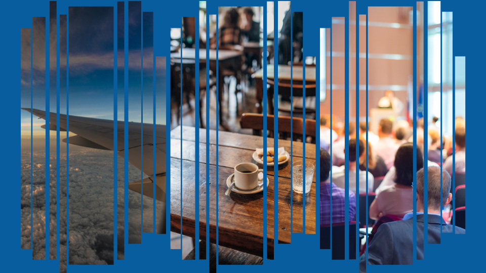
Spatial Perspectives on a Travel Day in 2022
Let’s explore how we think spatially on a typical day where Barbaree and Joseph travel from separate locations to present at a conference together.
Barbaree: Planning a trip to a GIS conference, thinking spatially, I consider the time of year and location of the conference in deciding specific clothing layers to bring. I also consider where to lodge: near the conference site but with enough distance to allow me to get some steps in each day. As I look at the lodging options, I think about hotel chains – their sizes and locations, and how they use the location of their competitors, zoning, traffic, the local labor pool, and the local real estate market to determine the optimal site for each.
Joseph: In planning my flight to the same conference, I think spatially about the direction the airplane will travel, and the left and right sides of the airplane. I choose a window seat that will provide me with a view to the south.
Barbaree: The day of the trip has arrived! As I access the Uber app to take me to the airport, I consider the Web GIS and GPS that are working behind the scenes to find the drivers nearest to my location. I marvel at how accurate the app is, on the map and in a temporal sense. I track my driver right up to the point that they appear at my residence.
Joseph: I live in a large metropolitan area, and on the way to the airport, my Uber driver navigates through a street lined with former motels that have now been converted to apartments and small business storefronts. Why? Before the interstate highways were built, this street was the main transportation route into and out of my city, spawning businesses that catered to travelers, the vestiges of which can still be seen today.
Barbaree: I live in a coastal area, and on my trip to the airport, I observe the low-lying countryside, considering the plans that homeowners have in place to evacuate in case of a hurricane strike, and the tools they use, such as weather forecasts and maps that, even if they don’t realize it, are all based on IoT feeds, remote sensing, and Web GIS capabilities. I consider the plans that communities have made for resiliency, again based on GIS technology.
Joseph: As I near the airport, I observe the sea of rental car facilities, package delivery services, and other land use that has clustered around the airport. I consider how certain businesses such as these, and antique malls and bail bonds, cluster together, while others, such as car washes and IKEA stores, tend to be dispersed a set distance away from each other. Site selection is critical to business success, and GIS plays a key role in demographic, zoning, and transportation analyses.
Barbaree: As I check in at the airport, I observe the spatial patterns, sometimes hub-and-spoke, on the route map for my airline. I consider not only that GIS is used to plan future expansion of my airline, but also for real-time monitoring and tracking of aircraft. I consider the large electric needs of the airport, and how GIS is used by the utility company to manage all the electric lines to operate everything from the baggage conveyor belt to the trains to the lighting on the concourse.
Joseph: As I board my airplane, spatial thinking is evident, from people finding their seats to how they are stowing their bags in the overhead compartment and under the seats. Often, those more seasoned spatial thinkers in these matters, the flight attendants, rearrange items in the bins so that more bags can fit.
Barbaree and Joseph: We arrive at our destination and agree to meet at a coffee shop near the conference site. We independently examine a map on our mobile devices, use mapping tools to determine the closest one, use the navigation tools to walk there, and greet each other once we arrive. Again thinking spatially, we choose a spot near a window to allow us to observe the local people and the skyline as we discuss our plans for the conference. As we sip our tea and coffee, we consider how and where the beverage ingredients were grown and harvested, and the supply chain management, enabled by GIS, that was employed to ship it to distributors and, finally, to the very shop where we are enjoying it.
Barbaree and Joseph: As we present our workshop the following day, we note where our presentation room is in the convention center, rearrange the seating so attendees can have the best visual and learning experiences, and tailor our GIS workshop to include local data and regional issues of concern to the attendees. All along our journey, we have made use of spatial thinking in the ways we mentioned and in dozens of other ways that Golledge mentions in his article.
Geography in Everyday Life infographic
Keep Learning!
Move forward in your geospatial journey with these resources:
- The NRC Learning to Think Spatially Report
- The Dr. Golledge article from 2000: https://www.directionsmag.com/article/4035
- The Geospatially Smart series: https://www.directionsmag.com/playlist/7333
- Keep Your Skills Fresh collection: https://www.directionsmag.com/playlist/8607
- A Day in the Life of a Spatial Thinker set of videos in the following playlist: https://www.youtube.com/playlist?list=PLiC1i3ejK5vs64qwBcdiZh6lzmHK-hdmq
- Learn more about your world by applying spatial thinking by working with the following compelling Web maps, apps, and field tools. Use the Esri Wayback imagery to examine change over space and time in your neighborhood.
- Use your fitness app to make 2D and 3D maps from your routes with relive.cc, Runkeeper, Strava, or others. Make color-coded choropleth maps of median age or home value or other variables in your own community with ArcGIS Online.
- Access a crowdsourced Survey123 about aggregate rock used in landscaping, trees, weather, and other examples. Create one of your own surveys on a topic you care about. How walkable is your community? Here is a walkability survey you can participate in: https://community.esri.com/t5/education-blog/how-walkable-is-your-community/ba-p/883382
- Engage in geocaching, wayfinding, GPS draw, Pokémon Go, or any other on-the-landscape type of game.
- Use historical Google Street Views to examine your street over time, your neighborhood, and other neighborhoods around the world.
- Create a story map.
- Host or participate in a GIS Day event.
- To dig deeper, try a few of these 15 short activities that are intended to be used in conjunction with the UCGIS Body of Knowledge chapters: https://community.esri.com/t5/education-blog/a-set-of-activities-for-teaching-core-content-from/ba-p/1139408

Download the Geography in Everyday Life infographic shown .