

Geography in Everyday Life – Part 2
By Reginald Golledge This article was originally published at Directions Magazine on March 21, 2001. There are two “geographies” of everyday life. One represents the “incidental” (or “naïve”) geographic knowledge that we acquire as...
Geography in Everyday Life
By Dr. Reginal Golledge This article was originally published at Directions Magazine on December 21, 2000. Many geographers today teach and research about concepts that are relevant to everyday life. This geographic knowledge enables us to understand the things we do...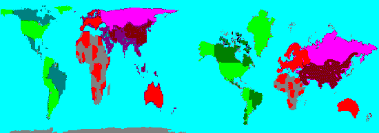
A More Realistic View of Our World
TCEA 2017
Learn about online mapping for your classroom! Catch a POSTER or PRESENTATION Tuesday, Feb. 7th, 9:00am, Poster Pavilion, “Where, Why, Who, What, How: Data and Online Mapping” Wednesday, Feb. 8th at 3:30pm, Room 8AB, “We All Have a Story to Share: Engage and Inspire...