We have turkey on the brain – and stuffing, and gravy, and cranberries…you get the picture. As you prepare for Thanksgiving this week, check out some of these wonderful maps and visualizations exploring Thanksgiving.
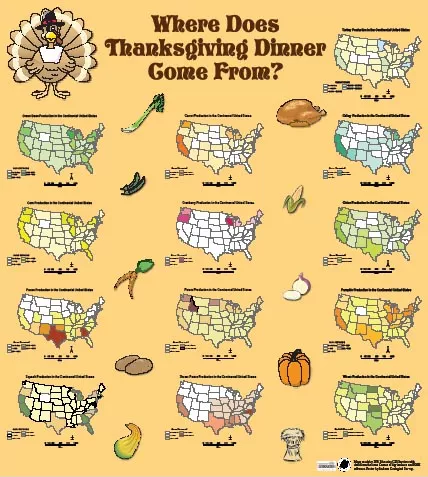
 Our first holiday map study (pictured left) is compiled by information from Thanksgiving Maps and Posters created by Esri. Like Zellmer’s original Thanksgiving maps, Esri’s map shows the number of turkeys and the acreage of sweet potatoes, cranberries, and green beans. The online mapping of Thanksgiving related produce and turkey is pulled from 2007 USDA data.
Click here to explore a map which mapped out Thanksgiving related search terms for recipes and meal ideas to see what families were thinking of preparing for their meals across the country. Top search item? Sweet Potato Casserole…delish!
Whether you’re travelling for the holidays or are hosting the big day, we wish you, your families and friends a happy Thanksgiving!
At GISetc.com we curate and bring you the best geography and science resources from the web. We hope our sharing will keep you up to date on the latest science and geospatial news.
![]()