Since it’s summer, most of us are spending a little more time on social media. If you’re like us, a lot of that means we’re taking and sharing more photos online of our summer fun – whether it’s vacations, time spent relaxing or on home projects.
Here are some great resources for adding your photos to a map, and for browsing the pictures of others.
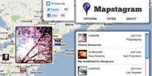
- Mapstagram – A real-time application that displays geotagged instagram photos from certain cities across the country.
- GramFeed – Another Instagram interface. This one is searchable by city and shows all the photos that are map tagged in that area.
- Flickr Map – With over a million geotagged photos, Flickr Map can place photos on a global map. It’s a great way to explore the world.
Happy summer! We look forward to following your photos!
At GISetc.com we curate and bring you the best geography and science resources from the web. We hope our sharing will keep you up to date on the latest science and geospatial news.

