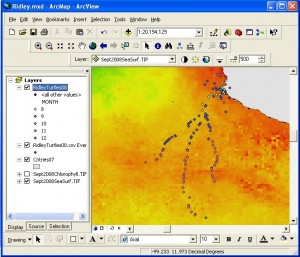
 Eyes In The Sky II is a NASA grant assisted program awarded to the Technical Educational Research Center (TERC) to lead a cohort of 100 science teachers to leverage NASA imagery to teach high school science. The course consists of two segments. The first, a 12 week online portion and a summer 7 day experience face to face. The online course introduces participants to several tools used to manipulate and analyze remote sensed imagery. We started by using the free program ImageJ which allows users to scale the image in order to measure features within or compare images of the same area over time. We then moved on to web sites that served imagery of various frequency ranges across the planet. NASA Earth Observation site, Modis’ image of the day program, Columbia’s Earth Observatory, and finally the Giovanni scientific visualization server. Once we had been introduced to how images might be useful we moved on to learning techniques at bringing them into ArcGIS and AEJEE where we could compare images to other data collected phenomena. We added GPS gathered points, invasive species, wildfires, river based landforms. Finally we compared these resources to what is available on Google Earth and how to combine these tools to be able to accomplish even more types of analysis.
 Eyes In The Sky II is a NASA grant assisted program awarded to the Technical Educational Research Center (TERC) to lead a cohort of 100 science teachers to leverage NASA imagery to teach high school science. The course consists of two segments. The first, a 12 week online portion and a summer 7 day experience face to face. The online course introduces participants to several tools used to manipulate and analyze remote sensed imagery. We started by using the free program ImageJ which allows users to scale the image in order to measure features within or compare images of the same area over time. We then moved on to web sites that served imagery of various frequency ranges across the planet. NASA Earth Observation site, Modis’ image of the day program, Columbia’s Earth Observatory, and finally the Giovanni scientific visualization server. Once we had been introduced to how images might be useful we moved on to learning techniques at bringing them into ArcGIS and AEJEE where we could compare images to other data collected phenomena. We added GPS gathered points, invasive species, wildfires, river based landforms. Finally we compared these resources to what is available on Google Earth and how to combine these tools to be able to accomplish even more types of analysis.