info@GISetc.com
  • Facebook
  • X
  • Facebook
  • X
GISetc
  • Home
  • About
  • Blog
  • Resources
  • Services
    • Services and Pricing
    • Get a Quote
  • Shop
Select Page

Disaster Response Map: U.S. Flooding

by Barbaree | May 16, 2011 | Free Resources, GIS Happenings, Our Blog

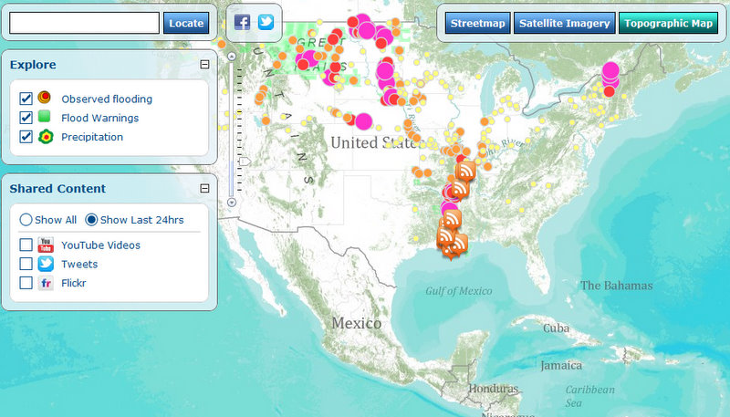
This map allows you to view continuously updated U.S. flooding information. You can see observed flooding locations as well as precipitation information.

The map also pulls in social media pertaining to flooding. In the Social Media box, you can change the search terms for YouTube, Twitter, and Flickr by hovering over the name of the feed, and then typing a new word into the displayed box.

On the blog

  • Supporting Women Working in the Geospatial Sciences: Sharing What We’ve Done & Learned
  • Geography in Everyday Life in 2022: How geography is embedded in our everyday lives
  • Geography in Everyday Life – Part 2
  • Geography in Everyday Life
  • Going Places with GIS and Geography
  • Apps We Love
  • ArcGIS Online
  • Articles
  • Conferences
  • Cougar's Corner
  • crafts
  • Current Training
  • Diana Sinton
  • DirectionsMag
  • Featured Content
  • Free Resources
  • GeoInspirations
  • GEOplaylist
  • Geoporter Report
  • GIS Day
  • GIS Happenings
  • GISetc Video Lessons
  • Joseph Kerski
  • Newsletter Archives
  • Our Blog
  • Past Training
  • Podcasts
  • Presentation & Conference Archives
  • Press & Testimonials
  • SEVEN
  • Super Tuesdays 2012
  • Uncategorized


Copyright GISetc, a division of Critical Think, Inc 2024

Dallas, Texas

  • Facebook
  • X

Designed by Elegant Themes | Powered by WordPress