 The employees of GISetc appreciate and support the service of our American military. In honor of Memorial Day this week, we are highlighting a week of geospatial links about our service men and women.
Instead of our typical app we share that you, as a consumer, can download, we are shaking it up this week. Today we are talking about an app that uses GIS and military cowdsourcing to make our military safer.
“The Army held a contest for iPhone and Android applications for software developers to see what they could do for the military market.
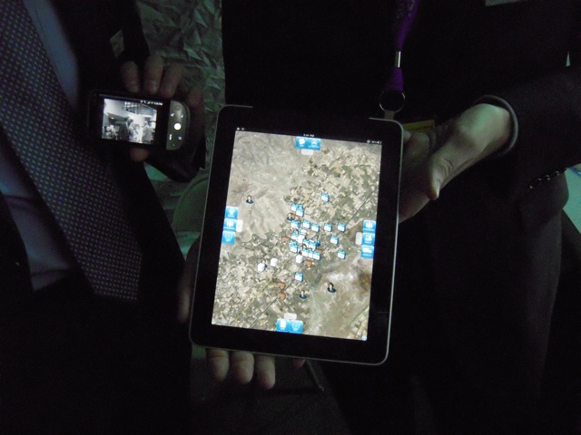
The above display on the iPad of a Textron Systems employee shows a map of friendly and hostile locations — the blue houses have U.S. troops in them — that soldiers can gather out in the field and send back to their command stations for further analysis. It’s running through SoldierEyes, a secure cloud that runs lots of little applets for intelligence, command-and-control and battlefield awareness, developed by two Textron subsidiaries, Overwatch and AAI.”
Click here to read more about SoldierEyes and other military applications.
At GISetc.com we curate and bring you the best geography and science resources from the web. We hope our sharing will keep you up to date on the latest science and geospatial news.
Originally posted at: http://www.wired.com/dangerroom/2010/10/tracking-the-bad-guys-yeah-theres-an-app-for-that/ by: Spencer Ackerman

