


TCEA Presentations
If you’re looking for cool things related to geospatial technology, digital maps and interactive online mapping….but need it to be free for your school. (Yes, FREE! No catch…really!) Join the TCEA GEOSIG and friends at one of these presentations...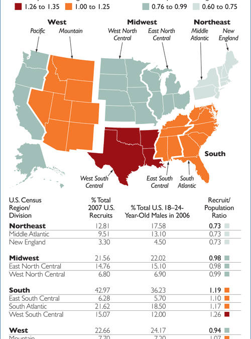
Honoring & Remembering Our Troops
With Armed Forces Day and Memorial Day both falling in May, as a nation, we all reflected on the call to service and sacrifice or our service men and women in our military. Freedom isn’t free, and we appreciate and recognize all soldiers, whether on active duty,...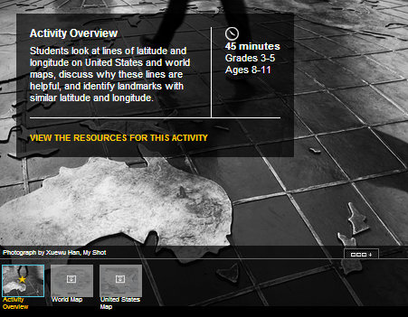
Mapping from National Geographic
National Geographic has a depth of cartographic resources online! We’ve been browsing their selection of educational content and found several free resources we thought you would enjoy sharing with your students. Location and Place in Your Classroom Introduction...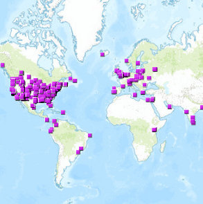
Add Yourself to the Map
Interactive maps are wonderful tools to explore data. Ever use them to find others like you in your field? Today we’re sharing a list of links to interactive maps, full of people like YOU. Whether you’re a geospatial professional, teacher or student...