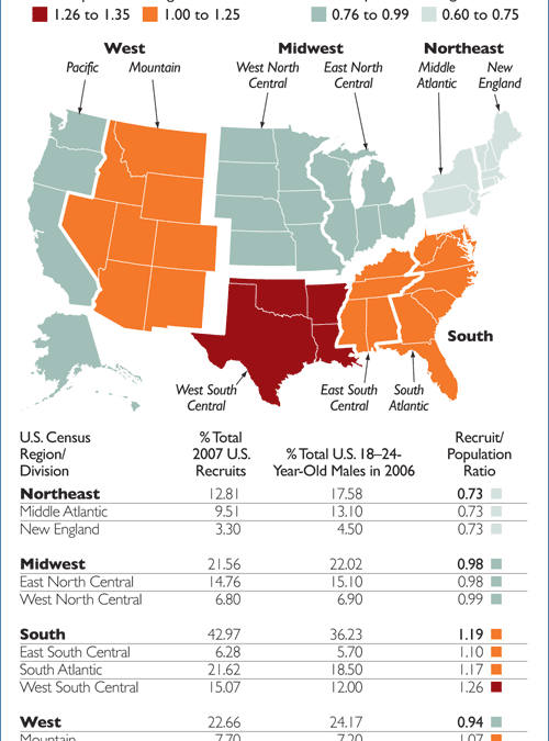
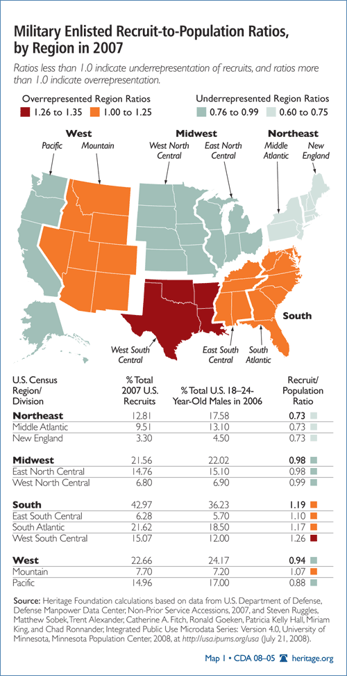
Map created by and originally hosted on www.heritage.org
With Armed Forces Day and Memorial Day both falling in May, as a nation, we all reflected on the call to service and sacrifice or our service men and women in our military. Freedom isn’t free, and we appreciate and recognize all soldiers, whether on active duty, veteran or fallen.
Among the staff members at GISetc, we have several family members both currently serving and veterans. We are honored to have our armed forces defending and representing our country.
To honor and remember our armed forces, we pulled together a collection of geospatial military resources for your classroom and students:
- Click the link to explore this great collection for data from Heritage.org. Filled with charts, information and maps about where our military comes from. Who Serves in the U.S. Military? The Demographics of Enlisted Troops and Officers
- Connect with the reality of our casualties and honor them by remembering their sacrifice. See the faces of our fallen service men and women, see where they were from and their age. Faces of the Fallen
- Click through each state and each base for a breakdown of information on troop installations in the U.S.
- See how the world is divided into military command zones and gain a deeper understanding of the chain of command across the globe.
We hope you take time to review these resources and reflect on the defenders of our freedom.
At GISetc.com we curate and bring you the best geography and science resources from the web. We hope our sharing will keep you up to date on the latest science and geospatial news.
![]()